 |
Warne
is located in southwest North Carolina, near the Georgia state line within the Nantahala National Forest. The community of Brasstown, well known for being home to the John C. Campbell Folk School, is just a few miles northeast of Warne. Activities in the Nantahala National Forest include hiking, biking, horseback riding, camping, canoeing and kayaking, fishing, Llama treks, gem mining and gold panning. The Nantahala River is popular for its' excellent Class I and Class II white water rafting. The town of Warne is located near the Clay and Cherokee County line, which is an area rich in Native American history. Part of the infamous Trail of Tears is located near Warne at Tatham Gap, a road that was built by the U.S. Army to transport the Cherokee from Fort Montgomery to Fort Delaney and beyond. The town of Andrews, which is the largest community in the region, is home to an Annual Fall Car Show, and an Annual Wagon Train, which is part of the 4th of July Celebration each year. In addition, there are tons of small town festivals and county fairs in the area, along with craft shows, flea markets and other historical points of interest. Besides those already mentioned, other nearby attractions include the Cherokee County Historical Museum, the Tellico ORV Area, Lake Hiwassee and the Hiwassee Dam, the Cherahaula Skyway, the Biltmore Estate near Asheville and the Great Smoky Mountains National Park.
Surrounding areas: Brasstown, North Carolina (4.8 mi), Hayesville, North Carolina (5.5 mi), Lake Chatuge Village, North Carolina (7.9 mi), Murphy, North Carolina (10.3 mi), Marble, North Carolina (12.6 mi), Lake Hiwassee, North Carolina (13.6 mi), Andrews, North Carolina (14.8 mi)
|

|
Warne Vacation Rentals
|

|
|
|
|
|
Warne Hotels and Resorts
|
|
|
| | | Hotels & Motels |
| Holiday Inn Express Hotel & Suites | 300 Big Sky Dr | Hiawassee, GA | 8.3 mi. | (706) 896-8884 | | Ramada Inn Lake Chatuge Lodge | 653 Hwy 76 | Hiawassee, GA | 8.3 mi. | (706) 896-5253 | | Seasons Inn | Box 10 On The SQ | Blairsville, GA | 9.0 mi. | (706) 745-1631 | | Holiday Inn Express | 333 Fisher St | Blairsville, GA | 9.2 mi. | (706) 745-6844 | | Best Western Murphy | 1522 Andrews Rd | Murphy, NC | 10.3 mi. | (828) 837-3060 | | Days Inn | 754 Hwy 64 W | Murphy, NC | 10.3 mi. | (828) 837-8030 | | Econo Lodge | 100 Ter St | Murphy, NC | 10.3 mi. | (828) 837-8880 | | Holiday Inn Express Hotel And Suites | 130 Holiday Dr | Murphy, NC | 10.3 mi. | (828) 837-1111 | | Andrews Valley Inn | Beavercreek Rd | Andrews, NC | 14.8 mi. | (888) 777-7901 | | Days Inn | 1100 Burkemont | Morganton, GA | 22.1 mi. | (828) 430-8778 | | Chattahoochee Ridge Lodge | | Helen, GA | 22.2 mi. | (706) 878-3144 | | Comfort Inn Helen | Edelweiss Dr | Helen, GA | 22.2 mi. | (706) 878-8000 | | Econo Lodge Helen | 749 Bruken Strase St | Helen, GA | 22.2 mi. | (706) 878-2141 | | Econo Lodge | 749 Brukenstasse St | Helen, GA | 22.2 mi. | (706) 878-2141 | | Heidi Motel Helen | 8820 North Main St | Helen, GA | 22.2 mi. | (706) 878-2689 | | Helendorf Aso | 33 Munichstrasse | Helen, GA | 22.2 mi. | (706) 878-2271 | | Holiday Inn Express | 8171 Hwy 75 N | Helen, GA | 22.2 mi. | (706) 878-8888 | | Ramada Limited | 11 Edelweiss St | Helen, GA | 22.2 mi. | (706) 878-1451 | | Unicoi State Park And Lodge | 1788 Hwy 356 | Helen, GA | 22.2 mi. | (706) 878-2201 | | Hampton Inn - Helen On The River | 147 Unicoi St | Helen, GA | 22.3 mi. | (706) 878-3310 | | Hofbrauhaus Inn | 1 Main St | Helen, GA | 22.6 mi. | (706) 878-2248 | | Best Western Alpine Helen | 8220 S Main St | Helen, GA | 22.7 mi. | (706) 878-2111 | | Days Inn Helen | 8288 S Main St | Helen, GA | 22.7 mi. | (706) 878-4079 | | Super 8 Motel-helen | 8396 S Main St | Helen, GA | 22.7 mi. | (706) 878-2191 | | Country Inn And Suites By Carlson | 877 Edelweiss Strasse | Helen, GA | 22.8 mi. | (706) 878-9000 | | Microtel Inn & Suites Robbinsville | 107 Rodney Orr By-Pass | Robbinsville, NC | 23.2 mi. | (828) 479-6772 | | San-ran Motel | | Robbinsville, NC | 23.2 mi. | (828) 479-3256 | | Comfort Inn & Suites | 83 Blue Rdg Overlook | Blue Ridge, GA | 26.0 mi. | (706) 946-3333 | | Douglas Inn & Suites | 1192 Windy RDG Rd | Blue Ridge, GA | 26.0 mi. | (706) 258-3600 | | Ramada Ltd-blue Ridge | 30 Overview Dr | Blue Ridge, GA | 26.0 mi. | (706) 632-4444 | | Trails End Cabins | Rt 1 Box 253 | Turtletown, TN | 27.6 mi. | (704) 494-4610 | | Best Western Copper Inn | US Hwy 64 | Ducktown, TN | 27.9 mi. | (423) 496-5541 | | Days Inn Cleveland | Hwy 129 | Cleveland, GA | 28.4 mi. | (706) 865-4079 | | Knights Inn | 3 Best Inn Way | Dillard, GA | 28.7 mi. | (706) 746-5321 | | Holiday Inn Express | 64 White Oak Ln | Dillard, GA | 28.8 mi. | (706) 746-3383 | | Days Inn | Hwy 441 Box 1176 | Clayton, GA | 29.0 mi. | (706) 782-4258 | | Quality Inn & Suites | 834 Hwy 441 S | Clayton, GA | 29.0 mi. | (800) 334-2214 | | Stonebrook Inn | Hwy 441 | Clayton, GA | 29.0 mi. | (706) 782-2214 |
| | | Bed & Breakfast |
| Angels Landing Inn | 94 Campbell St | Murphy, NC | 10.1 mi. | (828) 835-8877 |

|
Warne Weather & Climate
|

|
|
|
The Mountains, due to their mild summer temperatures, have always been a welcome escape from the heat at the lower elevations. Midsummer afternoon temperatures average only around 80 degrees at elevations of 3,000 feet or higher. Nights are crisp and cool, but seldom too cold for outdoor activities or camping. In winter, snowfall is likely most years, but ski resorts use snowmaking equipment to ensure a reliable supply. Large amounts of snow and extreme low temperatures are rare except at the highest peaks. Rainfall is common in spring and summer. In spring, storm systems that bring cold weather southward reach North Carolina less often and less forcefully than in other parts of the country. Occasional invasions of cool dry air from the north continue during the summer, but are of short duration. Fall has warm days and cool nights and is the driest period.
|
| Month |
High Temp |
Low Temp |
Rainfall |
Ocean Temp |
| January |
48°F |
25°F |
5.81 in. |
- |
| February |
52°F |
27°F |
5.07 in. |
- |
| March |
60°F |
33°F |
5.86 in. |
- |
| April |
69°F |
40°F |
4.58 in. |
- |
| May |
76°F |
49°F |
4.85 in. |
- |
| June |
82°F |
58°F |
4.76 in. |
- |
| July |
86°F |
62°F |
4.94 in. |
- |
| August |
85°F |
62°F |
4.66 in. |
- |
| September |
80°F |
56°F |
3.92 in. |
- |
| October |
71°F |
42°F |
3.13 in. |
- |
| November |
60°F |
34°F |
4.57 in. |
- |
| December |
51°F |
27°F |
4.91 in. |
- |

|
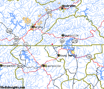
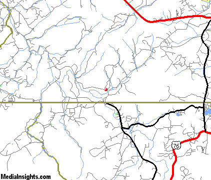
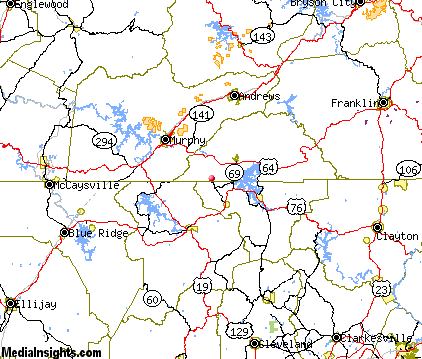
Warne Map & Transportation
|

|
|
 |
|
|
| Click each thumbnail image to enlarge. |
 |
|
 |
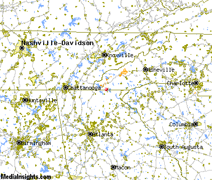 |
The closest airports in the area are the Mc Ghee Tyson airport (TYS) located about 56 miles north of Warne in Knoxville, Tennessee, the Gatlinburg Pigeon Forge airport (GKT) located approximately 63 miles northeast of Warne in Sevierville, Tennessee, Gwinnett County Briscoe Field (LZU) located roughly 70 miles south of Warne in Lawrenceville, Georgia, the Winder Barrow airport (WDR) located around 71 miles south of Warne in Winder, Georgia, and finally Lovell Field (CHA) located about 74 miles west of Warne in Chattanooga, Tennessee.
|

|
Warne Attractions
|

|
|
| | | Amusement and Theme Parks |
| Cherokee Fun Park | Cherokee | NC | 46.5 mi. | | | Santa's Land | Cherokee | NC | 46.5 mi. | | | Ghost Town in the Sky | Maggie Valley | NC | 57.6 mi. | | | Dollywood | Pigeon Forge | TN | 58.1 mi. | | | Rockin' Raceway | Pigeon Forge | TN | 58.1 mi. | | | NASCAR SpeedPark | Sevierville | TN | 63.2 mi. | | | Lake Winnepesaukah | Rossville | GA | 78.9 mi. | | | American Adventures | Marietta | GA | 81.1 mi. | | | Stone Mountain Park | Stone Mountain | GA | 83.5 mi. | |
| | | Water Parks |
| Lake Lanier Island Beach & Water Park | Lake Lanier Island | GA | 57.0 mi. | | | White Water Park | Marietta | GA | 81.1 mi. | |
| | | Golf Courses |
| Chatuge Shores Golf Course | Hayesville | NC | 5.6 mi. | | | Mountain Harbour Golf & Yacht Club | Hayesville | NC | 5.6 mi. | | | Butternut Creek Golf Course | Blairsville | GA | 9.0 mi. | | | Cherokee Hills Golf & Country Club | Murphy | NC | 10.2 mi. | | | Innsbruck Golf Club | Helen | GA | 22.4 mi. | | | Copper Basin Golf Club | Copperhill | TN | 27.0 mi. | | | Rabun Country Golf Club | Clayton | GA | 29.2 mi. | |
| | | Ski Areas |
| Scaly Mountain | Scaly Mountain | NC | 32.7 mi. | | | Cataloochee | Maggie Valley | NC | 57.6 mi. | | | Ski Wolf Laurel | Mars Hill | NC | 95.0 mi. | |
| | | State Parks |
| Chatuge State Park | | GA | 5.3 mi. | | | Vogel State Park | | GA | 18.3 mi. | | | Moccasin Creek State Park | | GA | 20.7 mi. | | | Unicoi State Park | | GA | 21.4 mi. | | | Black Rock Mountain State Park | | GA | 28.1 mi. | | | Amicalola Falls State Park | | GA | 35.9 mi. | |
| | | Museums |
| Sequoyah Birthplace Museum | Vonore | TN | 45.6 mi. | (History) |
| | | Zoos and Aquariums |
| Knoxville Zoological Gardens | Knoxville | TN | 66.8 mi. | | | Tennessee Aquarium | Chattanooga | TN | 80.3 mi. | | | Warner Park Zoo | Chattanooga | TN | 80.3 mi. | | | Greenville Zoo | Greenville | SC | 85.5 mi. | | | Western North Carolina Nature Center | Asheville | NC | 86.4 mi. | | | Zoo Atlanta | Atlanta | GA | 90.6 mi. | |
Notice a problem with the information on this page? Please notify us.
|
Disclaimer: We recommend you conduct your own research regarding all accomodations and attractions found on this website. The distances shown on this website are straight-line distances as the crow flies. The road distance may be considerably longer. You assume all liability for use of any information found on this website. No information is confirmed or warranted in any way. By using our services you agree to the terms and conditions of this disclaimer.
|
| We are the #1 site for your North Carolina Vacation presenting North Carolina vacation rentals, hotels, weather and map for each city. |
North Carolina Vacation .com
©1997-2025 All Rights Reserved.
|
|